
Lessona topographic map
Interactive map
Click on the map to display elevation.
About this map
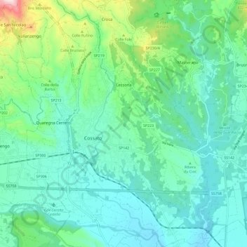
Name: Lessona topographic map, elevation, terrain.
Location: Lessona, Biella, Piëmont, 13853, Italië (45.53430 8.17455 45.61497 8.23936)
Average elevation: 294 m
Minimum elevation: 201 m
Maximum elevation: 644 m
Other topographic maps
Click on a map to view its topography, its elevation and its terrain.