
Camandona topographic map
Interactive map
Click on the map to display elevation.
About this map
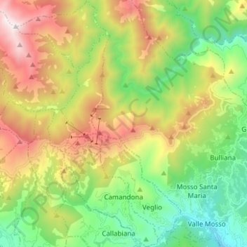
Name: Camandona topographic map, elevation, terrain.
Location: Camandona, Biella, Piëmont, 13821, Italië (45.62662 8.04554 45.71336 8.11782)
Average elevation: 1,039 m
Minimum elevation: 405 m
Maximum elevation: 2,027 m
Other topographic maps
Click on a map to view its topography, its elevation and its terrain.