
Río Ara topographic map
Interactive map
Click on the map to display elevation.
About this map
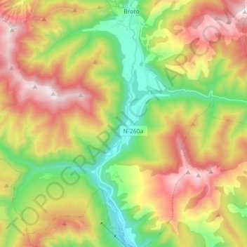
Name: Río Ara topographic map, elevation, terrain.
Location: Río Ara, Broto, Sobrarbe, Huesca, Aragón, 22370, España (42.50398 -0.14251 42.60744 -0.11920)
Average elevation: 1,324 m
Minimum elevation: 760 m
Maximum elevation: 2,021 m
Other topographic maps
Click on a map to view its topography, its elevation and its terrain.
Barranco Oscuro
Barranco Oscuro, Broto, Sobrarbe, Huesca, Aragón, España
Average elevation: 1,299 m