
Lalitpur topographic map
Interactive map
Click on the map to display elevation.
About this map
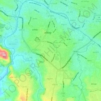
Name: Lalitpur topographic map, elevation, terrain.
Location: Lalitpur, Bagmati Pradesh, Nepal (27.64202 85.29178 27.69332 85.34357)
Average elevation: 1,312 m
Minimum elevation: 1,264 m
Maximum elevation: 1,431 m
Other topographic maps
Click on a map to view its topography, its elevation and its terrain.