
Thank you for supporting this site ❤️
Make a donation
Make a donation
Patan topographic map
Click on the map to display elevation.
Thank you for supporting this site ❤️
Make a donation
Make a donation
Patan
Lalitpur Metropolitan City (Sanskrit: पाटन Pāṭana, Nepal bhasa : 𑐫𑐮 Yela, ) is a Metropolitan city and fourth most populous city of Nepal with 299,843 inhabitants living in 49,044 households per 2021 cencus. It is located in the south-central part of Kathmandu Valley, a large valley in the high plateaus in central Nepal, at an altitude of 1,400 metres (4,600 feet).
Thank you for supporting this site ❤️
Make a donation
Make a donation
About this map
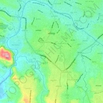
Name: Patan topographic map, elevation, terrain.
Average elevation: 1,312 m
Minimum elevation: 1,263 m
Maximum elevation: 1,431 m
Thank you for supporting this site ❤️
Make a donation
Make a donation