
Thank you for supporting this site ❤️
Make a donation
Make a donation
Kratie topographic map
Click on the map to display elevation.
Thank you for supporting this site ❤️
Make a donation
Make a donation
About this map
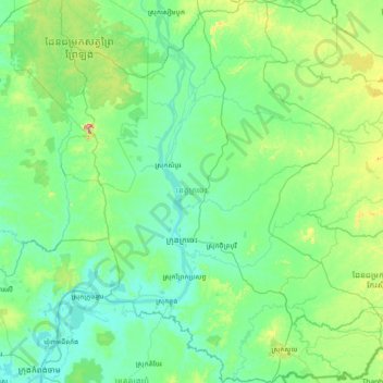
Name: Kratie topographic map, elevation, terrain.
Location: Kratie, Cambodia (11.94943 105.58718 13.40732 106.80199)
Average elevation: 76 m
Minimum elevation: 3 m
Maximum elevation: 601 m
Thank you for supporting this site ❤️
Make a donation
Make a donation
Other topographic maps
Click on a map to view its topography, its elevation and its terrain.