
Billenweid topographic map
Interactive map
Click on the map to display elevation.
About this map
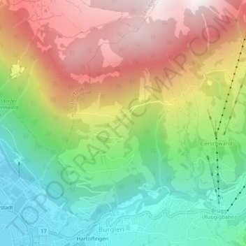
Name: Billenweid topographic map, elevation, terrain.
Location: Billenweid, Bürglen (UR), Uri, 6463, Schweiz (46.87671 8.65526 46.89671 8.67526)
Average elevation: 1,074 m
Minimum elevation: 464 m
Maximum elevation: 1,833 m
Other topographic maps
Click on a map to view its topography, its elevation and its terrain.