
Bürglen (UR) topographic map
Interactive map
Click on the map to display elevation.
About this map
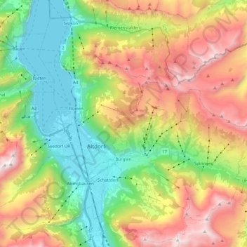
Name: Bürglen (UR) topographic map, elevation, terrain.
Location: Bürglen (UR), Uri, 6463, Schweiz (46.84730 8.63262 46.94146 8.83007)
Average elevation: 1,292 m
Minimum elevation: 422 m
Maximum elevation: 2,528 m
Other topographic maps
Click on a map to view its topography, its elevation and its terrain.
Billenweid
Schweiz > Uri > Bürglen (UR)
Billenweid, Bürglen (UR), Uri, 6463, Schweiz
Average elevation: 1,074 m