
Thank you for supporting this site ❤️
Make a donation
Make a donation
Avery topographic map
Click on the map to display elevation.
Thank you for supporting this site ❤️
Make a donation
Make a donation
About this map
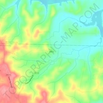
Name: Avery topographic map, elevation, terrain.
Location: Avery, Hickory County, Missouri, United States (38.04781 -93.38020 38.08781 -93.34020)
Average elevation: 248 m
Minimum elevation: 208 m
Maximum elevation: 309 m
Thank you for supporting this site ❤️
Make a donation
Make a donation
Other topographic maps
Click on a map to view its topography, its elevation and its terrain.