
Thank you for supporting this site ❤️
Make a donation
Make a donation
Bad Fallingbostel topographic map
Click on the map to display elevation.
Thank you for supporting this site ❤️
Make a donation
Make a donation
About this map
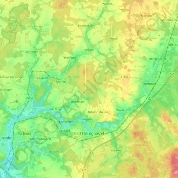
Name: Bad Fallingbostel topographic map, elevation, terrain.
Location: Bad Fallingbostel, Heidekreis, Lower Saxony, 29683, Germany (52.83850 9.64492 52.95730 9.86096)
Average elevation: 64 m
Minimum elevation: 27 m
Maximum elevation: 120 m
Thank you for supporting this site ❤️
Make a donation
Make a donation
Other topographic maps
Click on a map to view its topography, its elevation and its terrain.
Lüneburg Heath
Germany > Lower Saxony > Heidekreis > Soltau > Hötzingen > Emhof
Average elevation: 85 m
Thank you for supporting this site ❤️
Make a donation
Make a donation