
Pulwama topographic map
Interactive map
Click on the map to display elevation.
About this map
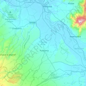
Name: Pulwama topographic map, elevation, terrain.
Location: Pulwama, Pulwama District, Jammu and Kashmir, India (33.78260 74.71196 34.01420 75.02896)
Average elevation: 1,719 m
Minimum elevation: 1,583 m
Maximum elevation: 2,952 m