
Thank you for supporting this site ❤️
Make a donation
Make a donation
Gabrovo topographic map
Click on the map to display elevation.
Thank you for supporting this site ❤️
Make a donation
Make a donation
About this map
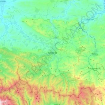
Name: Gabrovo topographic map, elevation, terrain.
Location: Gabrovo, 5303, Bulgaria (42.71103 25.15580 43.03103 25.47580)
Average elevation: 644 m
Minimum elevation: 177 m
Maximum elevation: 2,068 m
Thank you for supporting this site ❤️
Make a donation
Make a donation
Other topographic maps
Click on a map to view its topography, its elevation and its terrain.