
Жълтешка река topographic map
Interactive map
Click on the map to display elevation.
About this map
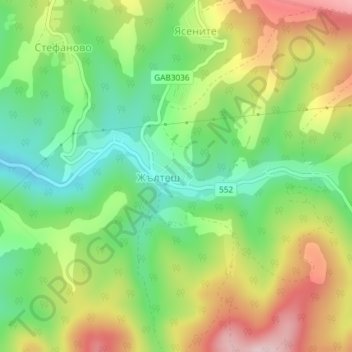
Name: Жълтешка река topographic map, elevation, terrain.
Location: Жълтешка река, Zhaltesh, Gabrovo, 5335, Bulgaria (42.85575 25.38049 42.85919 25.39193)
Average elevation: 578 m
Minimum elevation: 460 m
Maximum elevation: 739 m