
Thank you for supporting this site ❤️
Make a donation
Make a donation
Tegernsee topographic map
Click on the map to display elevation.
Thank you for supporting this site ❤️
Make a donation
Make a donation
About this map
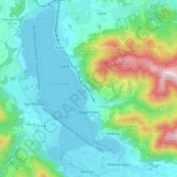
Name: Tegernsee topographic map, elevation, terrain.
Location: Tegernsee, Landkreis Miesbach, Bavaria, 83684, Germany (47.68892 11.71849 47.74774 11.81328)
Average elevation: 858 m
Minimum elevation: 722 m
Maximum elevation: 1,328 m
Thank you for supporting this site ❤️
Make a donation
Make a donation
Other topographic maps
Click on a map to view its topography, its elevation and its terrain.