
Jung-dong topographic map
Interactive map
Click on the map to display elevation.
About this map
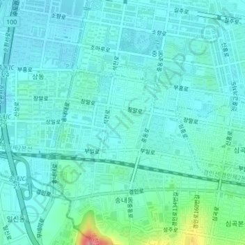
Name: Jung-dong topographic map, elevation, terrain.
Location: Jung-dong, Bucheon-si, Gyeonggi, South Korea (37.48522 126.75342 37.49763 126.77508)
Average elevation: 24 m
Minimum elevation: 8 m
Maximum elevation: 104 m
Other topographic maps
Click on a map to view its topography, its elevation and its terrain.
Simgokbon-dong
South Korea > Bucheon-si > Simgokbon-dong
Simgokbon-dong, Daesan-dong, Bucheon-si, Ojeong-gu, Gyeonggi-do, South Korea
Average elevation: 72 m
Gogangbon-dong
South Korea > Bucheon-si > Gogangbon-dong
Gogangbon-dong, Bucheon-si, Ojeong-gu, South Korea
Average elevation: 28 m