
Gogangbon-dong topographic map
Interactive map
Click on the map to display elevation.
About this map
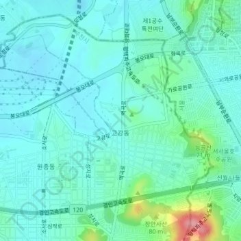
Name: Gogangbon-dong topographic map, elevation, terrain.
Location: Gogangbon-dong, Bucheon-si, Ojeong-gu, South Korea (37.51979 126.79876 37.54354 126.82885)
Average elevation: 28 m
Minimum elevation: 7 m
Maximum elevation: 118 m