
树掌镇 topographic map
Interactive map
Click on the map to display elevation.
About this map
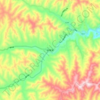
Name: 树掌镇 topographic map, elevation, terrain.
Location: 树掌镇, 长治市, 山西省, 中国 (35.85070 113.37300 35.93070 113.45300)
Average elevation: 1,410 m
Minimum elevation: 1,113 m
Maximum elevation: 1,752 m
Other topographic maps
Click on a map to view its topography, its elevation and its terrain.