
St. Cloud topographic map
Interactive map
Click on the map to display elevation.
About this map
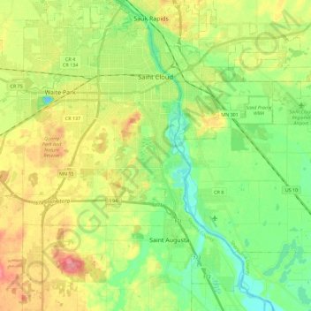
Name: St. Cloud topographic map, elevation, terrain.
Location: St. Cloud, Stearns County, Minnesota, États-Unis d'Amérique (45.45248 -94.26142 45.59035 -94.03577)
Average elevation: 319 m
Minimum elevation: 285 m
Maximum elevation: 367 m
Other topographic maps
Click on a map to view its topography, its elevation and its terrain.
Cold Spring
États-Unis d'Amérique > Minnesota > Stearns County
Cold Spring, Stearns County, Minnesota, 56320, États-Unis d'Amérique
Average elevation: 349 m