
Bishop topographic map
Interactive map
Click on the map to display elevation.
About this map
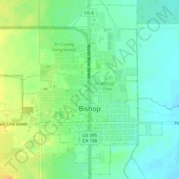
Name: Bishop topographic map, elevation, terrain.
Average elevation: 1,265 m
Minimum elevation: 1,253 m
Maximum elevation: 1,282 m
Bishop liegt auf 1264 m Höhe am Nordende des Owens Valley. Im Westen erstreckt sich das Gebirge der Sierra Nevada und im Osten die White Mountains. Die Stadt liegt am Bishop Creek, dem größten Zufluss des Owens River.
Other topographic maps
Click on a map to view its topography, its elevation and its terrain.
Badwater Basin
Vereinigte Staaten von Amerika > Kalifornien > Inyo County
Badwater Basin, Inyo County, Kalifornien, Vereinigte Staaten von Amerika
Average elevation: 152 m
Lone Pine
Vereinigte Staaten von Amerika > Kalifornien > Inyo County
Lone Pine, Inyo County, Kalifornien, 93545, Vereinigte Staaten von Amerika
Average elevation: 1,298 m