
Beauraing topographic map
Interactive map
Click on the map to display elevation.
About this map
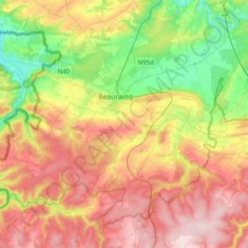
Name: Beauraing topographic map, elevation, terrain.
Location: Beauraing, Dinant, Namur, Wallonia, Belgium (50.01749 4.81909 50.16527 5.08079)
Average elevation: 262 m
Minimum elevation: 99 m
Maximum elevation: 446 m
Other topographic maps
Click on a map to view its topography, its elevation and its terrain.