
Thank you for supporting this site ❤️
Make a donation
Make a donation
Kelmis topographic map
Click on the map to display elevation.
Thank you for supporting this site ❤️
Make a donation
Make a donation
About this map
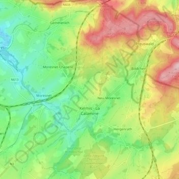
Name: Kelmis topographic map, elevation, terrain.
Location: Kelmis, Verviers, Liège, Wallonia, Belgium (50.69153 5.98174 50.75429 6.06157)
Average elevation: 233 m
Minimum elevation: 141 m
Maximum elevation: 366 m
Thank you for supporting this site ❤️
Make a donation
Make a donation
Other topographic maps
Click on a map to view its topography, its elevation and its terrain.