
Boyd County topographic map
Interactive map
Click on the map to display elevation.
About this map
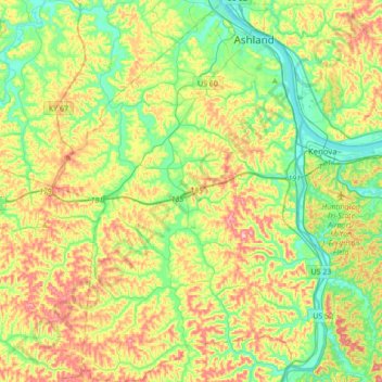
Name: Boyd County topographic map, elevation, terrain.
Location: Boyd County, Kentucky, United States of America (38.23603 -82.81805 38.50581 -82.57188)
Average elevation: 226 m
Minimum elevation: 155 m
Maximum elevation: 341 m
Other topographic maps
Click on a map to view its topography, its elevation and its terrain.
Henderson
United States of America > Kentucky > Henderson
Henderson, Henderson County, Kentucky, 42419, United States of America
Average elevation: 118 m
Pikeville
United States of America > Kentucky > Pikeville
Pikeville, Pike County, Kentucky, United States of America
Average elevation: 338 m
Green County
United States of America > Kentucky
Green County, Kentucky, United States of America
Average elevation: 230 m