
Rickatshofen topographic map
Interactive map
Click on the map to display elevation.
About this map
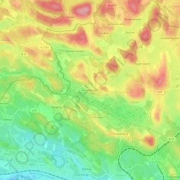
Name: Rickatshofen topographic map, elevation, terrain.
Average elevation: 458 m
Minimum elevation: 394 m
Maximum elevation: 524 m
Other topographic maps
Click on a map to view its topography, its elevation and its terrain.
Unterreitnau
Deutschland > Bayern > Landkreis Lindau > Lindau (Bodensee) > Unterreitnau
Unterreitnau, Lindau (Bodensee), Landkreis Lindau, Bayern, 88142, Deutschland
Average elevation: 461 m
Bechtersweiler
Deutschland > Bayern > Landkreis Lindau > Lindau (Bodensee) > Unterreitnau > Bechtersweiler
Bechtersweiler, Unterreitnau, Lindau (Bodensee), Landkreis Lindau, Bayern, 88142, Deutschland
Average elevation: 471 m