
上江镇 topographic map
Interactive map
Click on the map to display elevation.
About this map
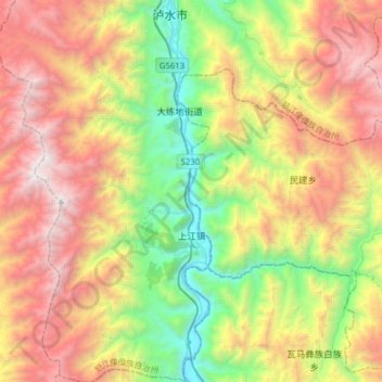
Name: 上江镇 topographic map, elevation, terrain.
Location: 上江镇, 泸水市, 怒江傈僳族自治州, 云南省, 中国 (25.55258 98.70995 25.83527 98.89136)
Average elevation: 2,045 m
Minimum elevation: 737 m
Maximum elevation: 3,754 m
Other topographic maps
Click on a map to view its topography, its elevation and its terrain.