
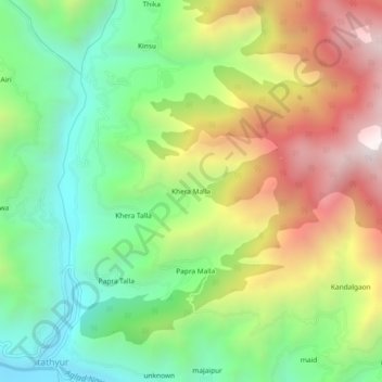
Khera Malla topographic map
Interactive map
Click on the map to display elevation.
About this map
Name: Khera Malla topographic map, elevation, terrain.
Average elevation: 1,657 m
Minimum elevation: 1,141 m
Maximum elevation: 2,396 m
Other topographic maps
Click on a map to view its topography, its elevation and its terrain.
Miyani
India > Uttarakhand > Dhanaulti
Miyani, Dhanaulti, Tehri Garhwal District, Uttarakhand, 249186, India
Average elevation: 1,499 m
unknown
India > Uttarakhand > Dhanaulti
unknown, Dhanaulti, Tehri Garhwal, Uttarakhand, India
Average elevation: 1,971 m
Khand
India > Uttarakhand > Dhanaulti > Ramolgaon
Khand, Ramolgaon, Dhanaulti, Tehri Garhwal, Uttarakhand, 249196, India
Average elevation: 1,032 m
Jaidwar Talla
India > Uttarakhand > Dhanaulti > Jaidwar Talla
Jaidwar Talla, Dhanaulti, Tehri Garhwal, Uttarakhand, India
Average elevation: 1,494 m