unknown topographic map
Interactive map
Click on the map to display elevation.
About this map
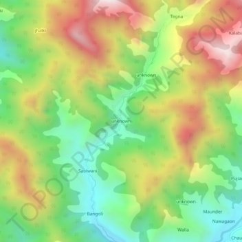
Name: unknown topographic map, elevation, terrain.
Location: unknown, Dhanaulti, Tehri Garhwal, Uttarakhand, India (30.36772 78.23978 30.40772 78.27978)
Average elevation: 1,971 m
Minimum elevation: 1,572 m
Maximum elevation: 2,487 m
Other topographic maps
Click on a map to view its topography, its elevation and its terrain.
Khera Malla
India > Uttarakhand > Dhanaulti
Khera Malla, Dhanaulti, Tehri Garhwal District, Uttarakhand, 249180, India
Average elevation: 1,657 m
Miyani
India > Uttarakhand > Dhanaulti
Miyani, Dhanaulti, Tehri Garhwal District, Uttarakhand, 249186, India
Average elevation: 1,499 m
Khand
India > Uttarakhand > Dhanaulti > Ramolgaon
Khand, Ramolgaon, Dhanaulti, Tehri Garhwal, Uttarakhand, 249196, India
Average elevation: 1,032 m
Jaidwar Talla
India > Uttarakhand > Dhanaulti > Jaidwar Talla
Jaidwar Talla, Dhanaulti, Tehri Garhwal, Uttarakhand, India
Average elevation: 1,494 m