
Thank you for supporting this site ❤️
Make a donation
Make a donation
Kankan Region topographic map
Click on the map to display elevation.
Thank you for supporting this site ❤️
Make a donation
Make a donation
About this map
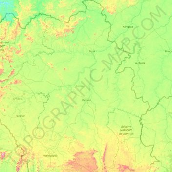
Name: Kankan Region topographic map, elevation, terrain.
Location: Kankan Region, Guinea (8.84164 -10.89240 12.50624 -7.94509)
Average elevation: 448 m
Minimum elevation: 149 m
Maximum elevation: 1,836 m
Thank you for supporting this site ❤️
Make a donation
Make a donation
Other topographic maps
Click on a map to view its topography, its elevation and its terrain.