
Valapattanam topographic map
Click on the map to display elevation.
About this map
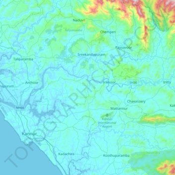
Name: Valapattanam topographic map, elevation, terrain.
Location: Valapattanam, Taliparamba, Kannur District, Kerala, India (11.93009 75.29567 12.02079 75.68054)
Average elevation: 86 m
Minimum elevation: -4 m
Maximum elevation: 1,013 m
Other topographic maps
Click on a map to view its topography, its elevation and its terrain.
Taliparamba
India > Kerala > Taliparamba
Taliparamba is located at 12°03′N 75°21′E / 12.05°N 75.35°E / 12.05; 75.35. It has an average elevation of 56 metres (184 ft) above sea level. The surrounding area (including the villages of Pattuvam, Pariyaram, Kuttiyeri, Karimbam, and Koonam) features lush green fields and low rolling hills.…
Average elevation: 35 m