
La Gouile topographic map
Interactive map
Click on the map to display elevation.
About this map
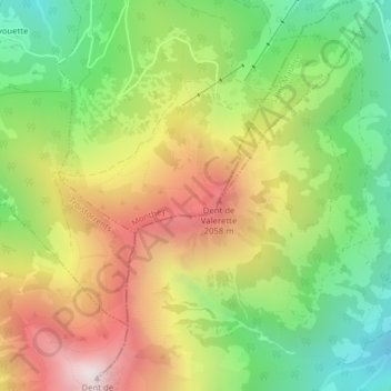
Name: La Gouile topographic map, elevation, terrain.
Location: La Gouile, Route du Milieu, Monthey, Vallese, 1871, Svizzera (46.20747 6.94973 46.20792 6.95029)
Average elevation: 1,609 m
Minimum elevation: 1,077 m
Maximum elevation: 2,259 m
Other topographic maps
Click on a map to view its topography, its elevation and its terrain.
Tête du Géant
Tête du Géant, Monthey, Vallese, 1875, Svizzera
Average elevation: 1,813 m
Pointe de Chésery
Pointe de Chésery, Monthey, Vallese, Svizzera
Average elevation: 1,884 m