
Pointe de Chésery topographic map
Interactive map
Click on the map to display elevation.
About this map
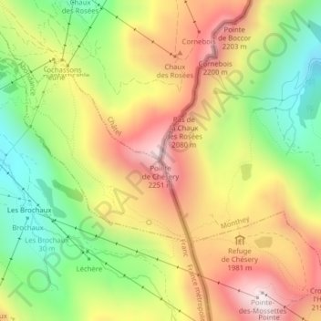
Name: Pointe de Chésery topographic map, elevation, terrain.
Location: Pointe de Chésery, Monthey, Vallese, Svizzera (46.20308 6.80327 46.20318 6.80337)
Average elevation: 1,884 m
Minimum elevation: 1,517 m
Maximum elevation: 2,262 m
Other topographic maps
Click on a map to view its topography, its elevation and its terrain.