Darend topographic map
Click on the map to display elevation.
About this map
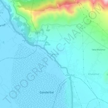
Name: Darend topographic map, elevation, terrain.
Average elevation: 1,666 m
Minimum elevation: 1,582 m
Maximum elevation: 2,167 m

Click on the map to display elevation.
Name: Darend topographic map, elevation, terrain.
Average elevation: 1,666 m
Minimum elevation: 1,582 m
Maximum elevation: 2,167 m