
Der Queckborn topographic map
Interactive map
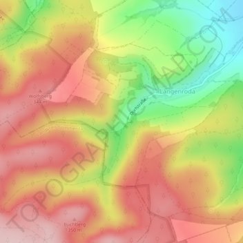
Click on the map to display elevation.
About this map
Name: Der Queckborn topographic map, elevation, terrain.
Average elevation: 274 m
Minimum elevation: 144 m
Maximum elevation: 366 m
Other topographic maps
Click on a map to view its topography, its elevation and its terrain.
Roßleben-Wiehe
Deutschland > Thüringen > Roßleben-Wiehe
Roßleben-Wiehe, Kyffhäuserkreis, Thüringen, 06571, Deutschland
Average elevation: 195 m