
Karangtempel topographic map
Interactive map
Click on the map to display elevation.
About this map
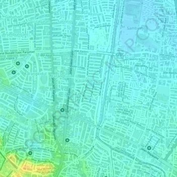
Name: Karangtempel topographic map, elevation, terrain.
Average elevation: 9 m
Minimum elevation: 3 m
Maximum elevation: 31 m
Other topographic maps
Click on a map to view its topography, its elevation and its terrain.
Bulusan
Indonésie > Java central > Semarang
Bulusan, Tembalang, Semarang, Java central, 50277, Indonésie
Average elevation: 140 m
Karanganyar
Indonésie > Java central > Semarang
Karanganyar, Tugu, Semarang, Java central, Indonésie
Average elevation: 7 m