
Kitty Hawk topographic map
Click on the map to display elevation.
Kitty Hawk
Kitty Hawk is located at 36°06′N 75°42′W / 36.1°N 75.7°W / 36.1; -75.7 at an elevation of 7 feet (2 m) above sea level.
About this map
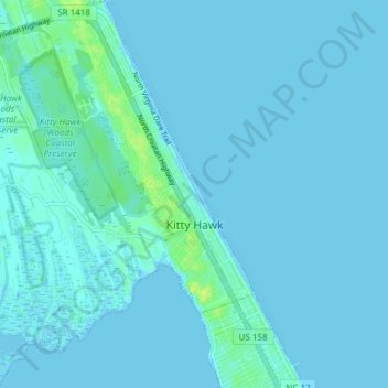
Name: Kitty Hawk topographic map, elevation, terrain.
Location: Kitty Hawk, Dare County, North Carolina, United States (36.04070 -75.74332 36.10155 -75.68188)
Average elevation: 2 m
Minimum elevation: -2 m
Maximum elevation: 14 m
Other topographic maps
Click on a map to view its topography, its elevation and its terrain.