
San Vicente de Cañete topographic map
Interactive map
Click on the map to display elevation.
About this map
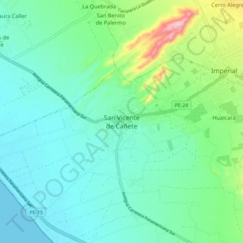
Name: San Vicente de Cañete topographic map, elevation, terrain.
Location: San Vicente de Cañete, Cañete, Lima, Perú (-13.11774 -76.42741 -13.03774 -76.34741)
Average elevation: 47 m
Minimum elevation: 0 m
Maximum elevation: 212 m
La ciudad de San Vicente de Cañete se encuentra a 144 km de la ciudad de Lima, a orillas del río Cañete, a una altitud de 40 msnm.
Other topographic maps
Click on a map to view its topography, its elevation and its terrain.
Nuevo Cañete
Perú > Lima > San Vicente de Cañete
Nuevo Cañete, San Vicente de Cañete, Cañete, Lima, Perú
Average elevation: 129 m