
Thank you for supporting this site ❤️
Make a donation
Make a donation
Balearic Islands topographic map
Click on the map to display elevation.
Thank you for supporting this site ❤️
Make a donation
Make a donation
Balearic Islands
Located in the west of the Mediterranean Sea, the Balearic Islands have mostly typical hot-summer Mediterranean climates (Köppen: Csa) with some high altitude areas having a Warm-summer Mediterranean climate (Köppen: Csb) in the island of Majorca. The semi-arid climate (Köppen: BSh and BSk) is also found in the Balearic Islands, mostly on the islands of Ibiza and Formentera but also in the southern part of Majorca.
Thank you for supporting this site ❤️
Make a donation
Make a donation
About this map
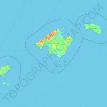
Name: Balearic Islands topographic map, elevation, terrain.
Location: Balearic Islands, Spain (38.64045 1.15727 40.09459 4.32803)
Average elevation: 9 m
Minimum elevation: -4 m
Maximum elevation: 1,317 m
Thank you for supporting this site ❤️
Make a donation
Make a donation
Other topographic maps
Click on a map to view its topography, its elevation and its terrain.