
Thank you for supporting this site ❤️
Make a donation
Make a donation
Hamilton County topographic map
Click on the map to display elevation.
Thank you for supporting this site ❤️
Make a donation
Make a donation
About this map
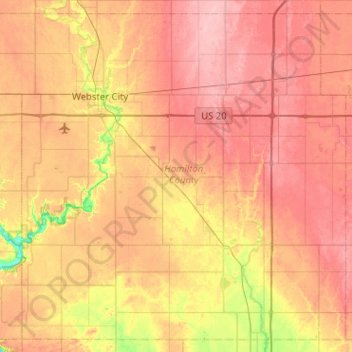
Name: Hamilton County topographic map, elevation, terrain.
Location: Hamilton County, Iowa, United States (42.20918 -93.97157 42.55813 -93.46266)
Average elevation: 341 m
Minimum elevation: 277 m
Maximum elevation: 386 m
Thank you for supporting this site ❤️
Make a donation
Make a donation
Other topographic maps
Click on a map to view its topography, its elevation and its terrain.
Iowa City
United States > Iowa > Johnson County > Iowa City
The elevation at the Iowa City Municipal Airport is 668 ft (203.6 m) above sea level.
Average elevation: 225 m
Thank you for supporting this site ❤️
Make a donation
Make a donation