
Thank you for supporting this site ❤️
Make a donation
Make a donation
Davenport topographic map
Click on the map to display elevation.
Thank you for supporting this site ❤️
Make a donation
Make a donation
About this map
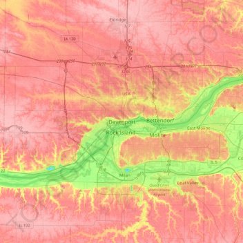
Name: Davenport topographic map, elevation, terrain.
Location: Davenport, Scott County, Iowa, 52801, United States (41.36364 -90.73764 41.68364 -90.41764)
Average elevation: 212 m
Minimum elevation: 140 m
Maximum elevation: 247 m
Thank you for supporting this site ❤️
Make a donation
Make a donation