
Amriswil topographic map
Interactive map
Click on the map to display elevation.
About this map
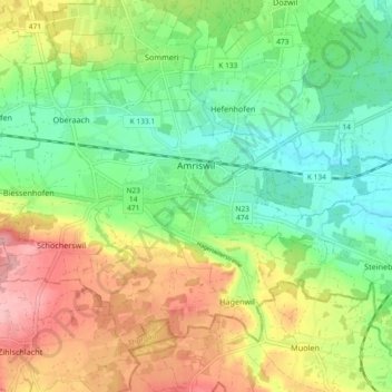
Name: Amriswil topographic map, elevation, terrain.
Location: Amriswil, Bezirk Arbon, Thurgau, Schweiz (47.52213 9.24740 47.56816 9.33957)
Average elevation: 473 m
Minimum elevation: 416 m
Maximum elevation: 557 m
Other topographic maps
Click on a map to view its topography, its elevation and its terrain.
Stachen
Schweiz > Thurgau > Bezirk Arbon > Arbon
Stachen, Arbon, Bezirk Arbon, Thurgau, 9320, Schweiz
Average elevation: 432 m
Hatswil
Schweiz > Thurgau > Bezirk Arbon > Hefenhofen
Hatswil, Hefenhofen, Bezirk Arbon, Thurgau, 8580, Schweiz
Average elevation: 441 m