
Nefta topographic map
Interactive map
Click on the map to display elevation.
About this map
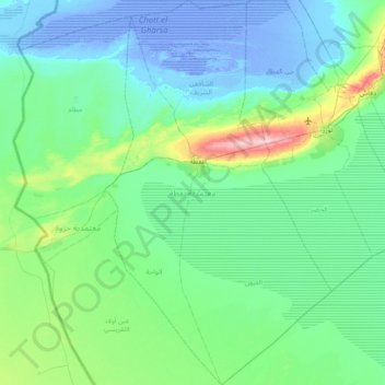
Name: Nefta topographic map, elevation, terrain.
Location: Nefta, Tozeur, 2240, Tunisie (33.50693 7.70010 34.13323 8.14482)
Average elevation: 24 m
Minimum elevation: -26 m
Maximum elevation: 182 m
Other topographic maps
Click on a map to view its topography, its elevation and its terrain.