
Nyagui topographic map
Interactive map
Click on the map to display elevation.
About this map
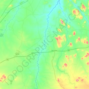
Name: Nyagui topographic map, elevation, terrain.
Location: Nyagui, Goromonzi, Mashonaland East Province, Zimbabwe (-17.76143 31.51586 -17.55296 31.57490)
Average elevation: 1,220 m
Minimum elevation: 1,107 m
Maximum elevation: 1,525 m
Other topographic maps
Click on a map to view its topography, its elevation and its terrain.
Nyagui
Zimbabwe > Mashonaland East Province > Goromonzi
Nyagui, Goromonzi, Mashonaland East Province, Zimbabwe
Average elevation: 1,303 m