
Lake Forest Park topographic map
Interactive map
Click on the map to display elevation.
About this map
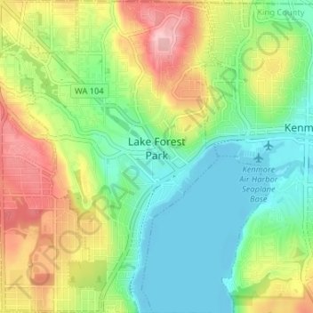
Name: Lake Forest Park topographic map, elevation, terrain.
Location: Lake Forest Park, King County, Washington, United States (47.73374 -122.31384 47.77742 -122.26756)
Average elevation: 65 m
Minimum elevation: -2 m
Maximum elevation: 171 m
Other topographic maps
Click on a map to view its topography, its elevation and its terrain.