
Thank you for supporting this site ❤️
Make a donation
Make a donation
Kunda topographic map
Click on the map to display elevation.
Thank you for supporting this site ❤️
Make a donation
Make a donation
About this map
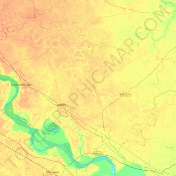
Name: Kunda topographic map, elevation, terrain.
Location: Kunda, Pratapgarh, Uttar Pradesh, India (25.57238 81.32497 25.93965 81.77562)
Average elevation: 102 m
Minimum elevation: 80 m
Maximum elevation: 115 m
Thank you for supporting this site ❤️
Make a donation
Make a donation
Other topographic maps
Click on a map to view its topography, its elevation and its terrain.
Kunda
India > Uttar Pradesh > Pratāpgarh
Kunda is located at 25°43′N 81°31′E / 25.72°N 81.52°E / 25.72; 81.52. It has an average elevation of 9 metres (291 feet). Kunda is not a very old town and probably was founded during the British Raj. Kunda is Located on Prayagraj-Lucknow National Highway 24B. Place is developing as main…
Average elevation: 103 m