
Lindberg topographic map
Interactive map
Click on the map to display elevation.
About this map
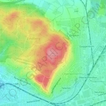
Name: Lindberg topographic map, elevation, terrain.
Location: Lindberg, Winterthur, Bezirk Winterthur, Zürich, 8404, Schweiz (47.51306 8.74691 47.51316 8.74701)
Average elevation: 482 m
Minimum elevation: 439 m
Maximum elevation: 553 m
Other topographic maps
Click on a map to view its topography, its elevation and its terrain.
Oberwinterthur
Schweiz > Zürich > Bezirk Winterthur > Winterthur
Oberwinterthur, Winterthur, Bezirk Winterthur, Zürich, Schweiz
Average elevation: 482 m