
Gunung Ijen topographic map
Interactive map
Click on the map to display elevation.
About this map
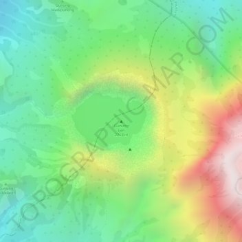
Name: Gunung Ijen topographic map, elevation, terrain.
Location: Gunung Ijen, Banyuwangi, Jatim, Indonésie (-8.05798 114.24305 -8.05788 114.24315)
Average elevation: 2,200 m
Minimum elevation: 1,841 m
Maximum elevation: 2,750 m
Other topographic maps
Click on a map to view its topography, its elevation and its terrain.
Malang Plain
Malang Plain, Malang, Jatim, 65138, Indonésie
Average elevation: 601 m
Gunung Argopuro
Gunung Argopuro, Probolinggo, Jatim, Indonésie
Average elevation: 2,644 m
Probolinggo
Indonésie > Jatim > Probolinggo
Probolinggo, Jatim, 62719, Indonésie
Average elevation: 57 m
Penanggungan
Penanggungan, Mojokerto, Jatim, Indonésie
Average elevation: 913 m