
El Khadhra topographic map
Interactive map
Click on the map to display elevation.
About this map
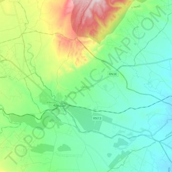
Name: El Khadhra topographic map, elevation, terrain.
Location: El Khadhra, Sbeitla, Kasserine, Tunisie (35.19808 9.09092 35.29486 9.27489)
Average elevation: 553 m
Minimum elevation: 413 m
Maximum elevation: 954 m
Other topographic maps
Click on a map to view its topography, its elevation and its terrain.