
Thank you for supporting this site ❤️
Make a donation
Make a donation
Khenchela topographic map
Click on the map to display elevation.
Thank you for supporting this site ❤️
Make a donation
Make a donation
About this map
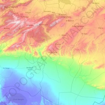
Name: Khenchela topographic map, elevation, terrain.
Location: Khenchela, Algeria (34.15429 6.49730 35.67288 7.54914)
Average elevation: 667 m
Minimum elevation: -32 m
Maximum elevation: 2,275 m
Thank you for supporting this site ❤️
Make a donation
Make a donation
Other topographic maps
Click on a map to view its topography, its elevation and its terrain.
Thank you for supporting this site ❤️
Make a donation
Make a donation
Thank you for supporting this site ❤️
Make a donation
Make a donation