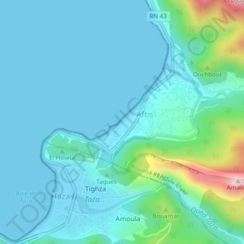
Plage des Aftis topographic map
Interactive map
Click on the map to display elevation.
About this map
Name: Plage des Aftis topographic map, elevation, terrain.
Average elevation: 63 m
Minimum elevation: 0 m
Maximum elevation: 405 m

Click on the map to display elevation.
Name: Plage des Aftis topographic map, elevation, terrain.
Average elevation: 63 m
Minimum elevation: 0 m
Maximum elevation: 405 m