
Aguas Vivas topographic map
Interactive map
Click on the map to display elevation.
About this map
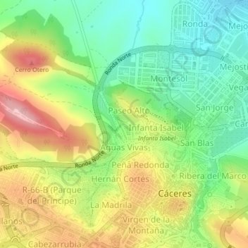
Name: Aguas Vivas topographic map, elevation, terrain.
Location: Aguas Vivas, Cáceres, Extremadura, España (39.47814 -6.38296 39.48599 -6.37544)
Average elevation: 423 m
Minimum elevation: 349 m
Maximum elevation: 521 m
Other topographic maps
Click on a map to view its topography, its elevation and its terrain.