
Thank you for supporting this site ❤️
Make a donation
Make a donation
Masally District topographic map
Click on the map to display elevation.
Thank you for supporting this site ❤️
Make a donation
Make a donation
About this map
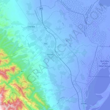
Name: Masally District topographic map, elevation, terrain.
Location: Masally District, Lankaran-Astara, Azerbaijan (38.85792 48.44061 39.20232 48.86548)
Average elevation: 65 m
Minimum elevation: -31 m
Maximum elevation: 1,074 m
Thank you for supporting this site ❤️
Make a donation
Make a donation
Other topographic maps
Click on a map to view its topography, its elevation and its terrain.